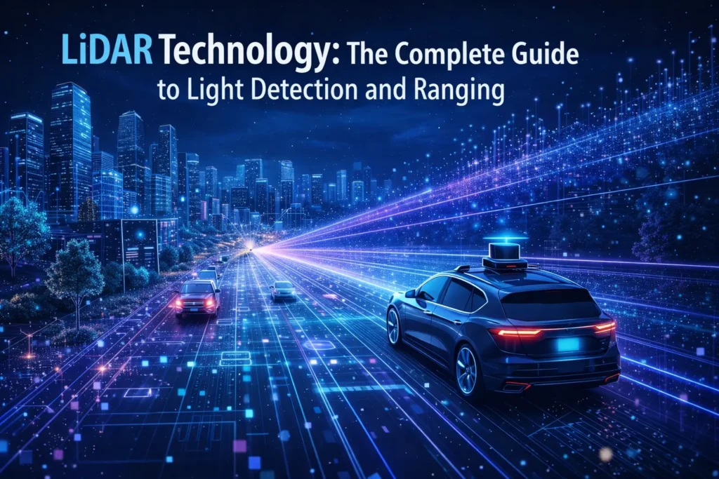
LiDAR technology has transformed how we measure, map, and understand the physical world. From guiding self-driving cars through city streets to revealing hidden ancient ruins beneath dense jungle canopies, LiDAR is one of the most powerful remote sensing tools available today. This complete guide covers everything you need to know: how LiDAR works, its core components, types and platforms, data outputs, industry applications, data processing workflows, costs, and the emerging innovations shaping its future.
What Is LiDAR Technology? Definition and Core Principles
LiDAR stands for Light Detection and Ranging. It is an active remote sensing method that uses rapid pulses of laser light to measure distances from a sensor to objects or surfaces on the ground, in the water, or in the air. By collecting millions of these measurements per second, a LiDAR system can build a highly accurate, three-dimensional representation of the surrounding environment.
The acronym is sometimes also rendered as an abbreviation for Laser Imaging, Detection, and Ranging. Regardless of interpretation, the underlying technology is the same. LiDAR was first developed in the 1960s, shortly after the invention of the laser itself, and saw early scientific applications in atmospheric research. The first practical topographic mapping systems emerged in the 1980s, championed by pioneering work at institutions including Hughes Aircraft and several U.S. universities.
The Basic Principle: How LiDAR Measures Distance
The fundamental operating principle of LiDAR is time-of-flight measurement. A LiDAR sensor emits a short, intense laser pulse. That pulse travels outward at the speed of light, strikes a surface or object, and a portion of the energy is reflected back to the sensor’s receiver (a photodetector). By measuring the time elapsed between the outgoing pulse and the returning signal, the system calculates the precise distance to that surface.
Distance = (Speed of Light x Time of Flight) / 2
Because the speed of light is a constant (approximately 299,792 km/s), even time differences measured in nanoseconds translate to distance measurements accurate to within centimeters. Modern LiDAR systems emit hundreds of thousands to several million pulses per second, accumulating a dense point cloud of precise 3D spatial data across an entire survey area in minutes.
LiDAR vs. Radar vs. Photogrammetry: A Quick Comparison
LiDAR is frequently compared to two other widely used technologies: radar and photogrammetry. Each has distinct strengths and is best suited to different scenarios. The table below provides a structured side-by-side comparison.
| Feature | LiDAR | Radar | Photogrammetry |
| Sensor type | Active | Active | Passive |
| Energy source | Laser pulses | Radio waves | Ambient light/camera |
| Typical accuracy | 1-5 cm | Centimeter to meter | 2-10 cm |
| Vegetation penetration | Excellent (multi-return) | Limited | Poor |
| Works in darkness | Yes | Yes | No |
| Works in rain/fog | Limited | Yes | No |
| Primary output | 3D point cloud | Distance/velocity | Textured 3D mesh |
| Cost | Moderate to High | Moderate to High | Low (drone + camera) |
| Best for | Precision mapping, forestry | Weather, long range | Visual 3D modeling |
In practice, LiDAR and photogrammetry are often used together. Photogrammetry produces photorealistic textured models, while LiDAR provides precise bare-earth elevation data that cameras alone cannot capture through dense vegetation. Radar excels at long-range detection and all-weather penetration but lacks the centimeter-level accuracy that modern LiDAR systems routinely achieve.
How a LiDAR System Works: Key Components Explained
A complete LiDAR system is made up of several tightly integrated hardware components. Understanding each component helps explain both the capabilities and the limitations of the technology.
The Laser Scanner: Wavelengths and Eye Safety
At the heart of every LiDAR system is a laser scanner, which generates and emits the light pulses used to probe the environment. The specific wavelength of the laser is one of the most important design choices, because it determines what the sensor can detect and how safely it interacts with human tissue, particularly the eyes.
| Wavelength | Type | Primary Use | Eye Safety |
| 532 nm (green) | Visible | Bathymetric (water penetration) | Lower threshold – caution required |
| 1064 nm (near-IR) | Near-infrared | Topographic land mapping | Eye-safe at low power levels |
| 1550 nm (SWIR) | Short-wave IR | Automotive, terrestrial | Highest eye-safety – preferred for AVs |
Most topographic airborne LiDAR systems use the 1064 nm near-infrared wavelength. This wavelength reflects strongly off vegetation and soil, making it ideal for mapping terrain and forest structure. Bathymetric LiDAR systems, designed to map shallow coastal waters and riverbeds, use 532 nm green light. Unlike infrared wavelengths, green light can penetrate water columns to depths of 20-70 meters, depending on water clarity. Many bathymetric systems fire both wavelengths simultaneously: the 1064 nm pulse reflects off the water surface to give a water surface elevation, while the 532 nm pulse penetrates to the bottom, allowing depth calculation.
Automotive and terrestrial LiDAR systems increasingly favour the 1550 nm short-wave infrared (SWIR) wavelength because it offers the highest level of eye safety, allowing higher power outputs (and thus longer range) without risk to pedestrians or bystanders. The 1550 nm band is absorbed by the eye’s anterior structures before reaching the retina, meaning significantly more laser energy is permitted before reaching the maximum permissible exposure threshold defined by international safety standards.
The Role of GPS and IMU in Georeferencing
A LiDAR sensor alone measures distance in all directions, but it has no inherent knowledge of where it is in the world or what direction it is pointing. Two additional instruments solve this problem and are essential for producing accurate, georeferenced spatial data.
The GNSS receiver (Global Navigation Satellite System — encompassing GPS, GLONASS, Galileo, and others) determines the precise geographic position of the sensor platform at every moment during data collection. In airborne surveys, the GNSS receiver on the aircraft is paired with one or more ground-based base stations to enable differential or RTK (Real-Time Kinematic) positioning, achieving accuracies of 2-5 cm in the horizontal plane.
The Inertial Measurement Unit (IMU) measures the sensor platform’s angular orientation: roll (side-to-side tilt), pitch (nose-up or nose-down), and yaw (rotation about the vertical axis). These three axes of rotation, combined with GNSS position, allow the system to calculate the precise origin and direction of every single laser pulse fired. Without a high-grade IMU, even millimeter-level range accuracy from the laser would translate into meter-level positional errors in the final point cloud.
Photodetectors and Receivers: Capturing the Return Signal
When a laser pulse strikes a surface, only a fraction of the emitted energy is reflected back toward the sensor. The photodetector (typically an avalanche photodiode, or APD) must detect these extremely faint return signals with precise timing. An APD operates by amplifying the initial photon signal through an internal gain mechanism, making it sensitive enough to detect single photons in some high-end systems.
The detector’s output feeds into a signal processing unit that records not just the arrival time of the return pulse (for range calculation) but also its intensity — the relative strength of the return signal. Intensity data adds a valuable additional dimension to the point cloud, as different materials reflect laser energy differently. Concrete, vegetation, water, and bare soil each have characteristic intensity signatures that help with automated feature classification during post-processing.
Types of LiDAR Systems and Platforms
LiDAR systems are classified in several ways: by the platform they are mounted on, by the type of terrain they are designed to map, and by their scanning mechanism. These distinctions have significant implications for which system is appropriate for a given project.
Airborne LiDAR: Drones, Planes, and Satellites
Airborne LiDAR is mounted on aircraft, helicopters, or unmanned aerial vehicles (UAVs/drones) that fly over the area of interest at altitudes typically ranging from 300 meters to several thousand meters for manned aircraft, and 30-150 meters for survey drones.
Manned aircraft systems are used for large-scale regional or national mapping projects — corridor mapping for highways and railways, national topographic databases, and large-scale forestry inventories. They offer high productivity, covering hundreds of square kilometers per day, but have high mobilization costs and are subject to airspace regulations.
UAV LiDAR has become increasingly popular for small- to medium-scale projects. Consumer-grade and survey-grade LiDAR sensors can now be integrated with multi-rotor and fixed-wing drones, enabling precise surveys of construction sites, quarries, archaeological sites, and agricultural fields at a fraction of the cost of manned aircraft. The lower flight altitude results in higher point density and improved resolution.
At the other extreme, spaceborne LiDAR instruments are mounted on satellites and spacecraft. NASA has deployed several landmark spaceborne LiDAR missions. The ICESat/GLAS mission measured polar ice sheet elevations over more than a decade, providing critical data for climate change research. The CALIPSO satellite uses a two-wavelength polarization lidar to study clouds and aerosol layers in the atmosphere. More recently, the ICESat-2 mission uses a photon-counting LiDAR approach to map global surface topography, sea ice thickness, and forest canopy height with unprecedented coverage.
Terrestrial and Mobile LiDAR
Terrestrial LiDAR systems are designed for use on or near the ground, and fall into two main categories: static and mobile.
Static (or tripod-mounted) terrestrial laser scanners (TLS) are set up at fixed positions, often in a scan-and-move workflow where the scanner is repositioned multiple times to achieve complete coverage of a scene. They offer extremely high point density and accuracy, making them ideal for as-built documentation of buildings and infrastructure, heritage recording, deformation monitoring, and detailed engineering surveys. These systems can scan at ranges exceeding 1 km with millimeter-level accuracy at close range.
Mobile LiDAR systems are mounted on vehicles — cars, vans, trains, boats, and even backpack or handheld rigs — and collect data continuously as the platform moves through the environment. They are widely used for road corridor surveys, utility mapping, rail inspection, and urban 3D modeling. Mobile systems require high-grade GNSS and IMU to achieve accurate georeferencing while moving. In urban canyons where GNSS signals are blocked by tall buildings, some systems incorporate SLAM (Simultaneous Localization and Mapping) algorithms to maintain positional accuracy.
Bathymetric vs. Topographic LiDAR
The distinction between topographic and bathymetric LiDAR is primarily one of wavelength and application domain. Topographic LiDAR, using near-infrared wavelengths (typically 1064 nm), is optimized for mapping land surfaces. It reflects effectively off terrain, vegetation, buildings, and other above-ground features. Topographic systems cannot penetrate water, as near-infrared energy is almost entirely absorbed by even shallow water columns.
Bathymetric LiDAR uses 532 nm green light to penetrate the water column and map the seafloor, riverbeds, and submerged coastal features. Most bathymetric systems simultaneously fire a 1064 nm pulse (to measure the water surface) and a 532 nm pulse (to measure the bottom), enabling direct calculation of water depth. Bathymetric LiDAR is heavily used by NOAA for coastal charting and by environmental agencies for habitat mapping in shallow marine and freshwater environments. Effective penetration depth depends on water turbidity: in clear tropical waters, depths of 60-70 meters may be achievable, while in turbid estuaries, effective depth may be limited to 5-10 meters.
Scanning Mechanisms: From Mechanical to Solid-State
LiDAR systems also differ in how they direct the laser beam across the field of view. Traditional mechanical scanners use a rotating mirror or prism to sweep the laser beam in a specific pattern. These systems are robust and well-understood but have moving parts that can wear over time — a significant concern for automotive applications where long-term reliability is critical.
Emerging solid-state LiDAR designs eliminate the moving parts problem. MEMS (Micro-Electro-Mechanical Systems) LiDAR uses microscopic mirrors fabricated on silicon chips to steer the laser beam. Flash LiDAR illuminates the entire scene at once with a broad laser pulse and uses a detector array to capture the return signals simultaneously. Phased Array LiDAR steers the beam electronically with no moving parts at all. These approaches offer lower manufacturing costs and greater durability, and are central to the long-term commercialization of automotive LiDAR.
From Raw Data to Insight: Understanding the Point Cloud
The primary output of a LiDAR survey is the point cloud — a large set of 3D data points representing the surfaces and objects detected by the sensor. Understanding the structure and attributes of a point cloud is essential for working with LiDAR data effectively.
What Is a Point Cloud?
A point cloud is a collection of individual data points, each defined by its X, Y, and Z coordinates in a three-dimensional space. In a georeferenced survey, X and Y represent the horizontal position (easting and northing, or longitude and latitude), while Z represents the elevation above a vertical datum. A typical airborne LiDAR survey might collect anywhere from 2 to 50 or more points per square meter, depending on the sensor, flight altitude, and project specifications.
In addition to 3D coordinates, each point typically carries several attributes. Intensity records the strength of the laser return signal. Return number indicates whether a point is a first, second, third, or last return from a given pulse — important for distinguishing vegetation layers. Classification assigns each point to a feature category (ground, low vegetation, medium vegetation, high vegetation, building, water, etc.). Some systems also record RGB color values by fusing the LiDAR data with simultaneously captured imagery, producing a colorized point cloud.
Discrete Return vs. Full Waveform LiDAR
Most commercial LiDAR systems record discrete returns: they detect each distinct peak in the return signal from a given laser pulse and record it as a separate point. A pulse fired through the top of a tree canopy might produce multiple returns — the first from the treetop, intermediate returns from branches and understory layers, and a final return from the ground beneath. This multi-return capability is one of LiDAR’s most significant advantages over photogrammetry, as it enables mapping of both the ground surface and the vertical structure of vegetation from the same dataset.
Full waveform LiDAR systems digitize the complete return signal from each pulse as a continuous waveform, capturing the full vertical distribution of reflective surfaces. This provides richer information about vegetation structure, canopy density, and biomass. Full waveform analysis can reveal subtle features that discrete return systems miss, such as low-lying shrubs beneath a closed forest canopy. However, full waveform data files are substantially larger and require more complex processing. Research institutions and national mapping agencies often prefer full waveform systems, while commercial survey firms typically use discrete return systems for their operational efficiency.
Key Data Attributes and File Formats
LiDAR point cloud data is most commonly stored in the LAS format (.las), a public file format specification maintained by the American Society for Photogrammetry and Remote Sensing (ASPRS). LAS files store point coordinates, intensity, return information, classification, GPS time, and other attributes in a compact binary format. The compressed variant, LAZ (.laz), offers lossless compression that reduces file sizes by 80-90% — essential when working with large area datasets that can easily exceed hundreds of gigabytes.
Derived raster products are commonly stored in GeoTIFF format. Key derived products include the Digital Terrain Model (DTM) or Digital Elevation Model (DEM), representing the bare-earth surface with all above-ground features removed; the Digital Surface Model (DSM), representing the first-return surface including vegetation and buildings; and the Canopy Height Model (CHM), the mathematical difference between the DSM and DTM, representing vegetation height above the ground.
The Top Applications of LiDAR Technology Across Industries
LiDAR’s ability to produce accurate, dense 3D spatial data quickly has made it indispensable across a remarkably diverse range of industries and scientific disciplines.
Surveying, Mapping, and Engineering
Land surveying and topographic mapping were among the earliest and remain among the most important applications of airborne LiDAR. National mapping agencies in the United States (USGS), United Kingdom (Ordnance Survey), and dozens of other countries have used LiDAR to create high-resolution national elevation datasets. The USGS 3DEP (3D Elevation Program) is a systematic initiative to collect LiDAR data for the entire contiguous United States at QL1 or QL2 quality standards.
In engineering and construction, LiDAR is used throughout the project lifecycle. At the planning stage, high-resolution DTMs enable accurate earthworks volume calculations and drainage analysis. During construction, mobile and UAV LiDAR enables regular stockpile volume monitoring and site progress tracking. For infrastructure asset management, mobile LiDAR surveys of roads, rail corridors, and utility lines (including powerline clearance inspections) provide detailed, measurable 3D records that can be revisited and compared over time. LiDAR data also feeds directly into Building Information Modeling (BIM) workflows through a process known as scan-to-BIM.
Autonomous Vehicles and Robotics
LiDAR is a cornerstone sensor in the autonomous vehicle (AV) industry. Self-driving cars rely on LiDAR to build a real-time 3D map of their immediate environment, detecting and localizing pedestrians, cyclists, other vehicles, road markings, and obstacles with the precision and speed required for safe navigation. Unlike cameras, LiDAR generates direct 3D range data and functions in complete darkness — a critical safety advantage.
Most AV systems use LiDAR in combination with cameras, radar, and ultrasonic sensors in a sensor fusion architecture. Each sensor modality compensates for the weaknesses of the others: cameras provide rich color and texture information, radar penetrates heavy rain and fog, and LiDAR delivers precise 3D geometry. The point cloud generated by a spinning mechanical LiDAR unit or a solid-state array is processed in real time by onboard computers running perception algorithms that classify and track surrounding objects.
Beyond cars, LiDAR is used extensively in robotics for navigation, obstacle detection, and path planning — in warehouse automation, agricultural robots, delivery robots, and autonomous mining vehicles.
Forestry, Agriculture, and Environmental Science
The ability of LiDAR to penetrate vegetation canopies and map ground topography beneath forest cover has made it transformative for ecological science and natural resource management. Forestry applications include measuring individual tree heights, estimating stem volume and above-ground biomass at landscape scale, mapping canopy gap fractions and light environments within forests, and monitoring changes in forest structure over time.
In precision agriculture, LiDAR-derived terrain models support drainage design, variable-rate irrigation planning, and identification of low-lying areas prone to waterlogging or frost. Some advanced agricultural systems use near-range LiDAR for direct crop canopy sensing — measuring plant height and volume to guide variable-rate fertilizer and pesticide applications.
Atmospheric and climate science depend heavily on spaceborne and airborne LiDAR. NASA’s CALIPSO mission has provided more than 18 years of global observations of aerosol distributions, cloud structure, and atmospheric boundary layer dynamics. These datasets are fundamental inputs to climate models and to our understanding of how aerosols — including pollution, smoke from wildfires, and sea salt — affect Earth’s energy balance. NOAA uses bathymetric LiDAR for coastal vulnerability assessments, tracking erosion and sediment dynamics in response to sea level rise and storm events.
Archaeology and Cultural Heritage
One of the most dramatic demonstrations of LiDAR’s power came in 2010, when archaeologists used airborne LiDAR to detect the vast urban grid of the medieval Khmer capital of Angkor beneath the jungle canopy of Cambodia — revealing a city far larger and more complex than ground-based surveys had suggested. Since then, LiDAR has been used to discover previously unknown settlements, road networks, field systems, and monuments across Central America, Southeast Asia, Africa, and Europe.
The technique works by processing the LiDAR point cloud to remove the returns from vegetation and produce a bare-earth DTM. Subtle microtopographic features — earthworks, building foundations, irrigation channels, ancient roads — that are invisible beneath jungle or farmland vegetation are revealed in striking clarity in these vegetation-peeled elevation models.
Urban Planning and Digital Twins
High-resolution LiDAR data of urban environments enables detailed 3D city modeling, which serves as the foundation for a wide range of planning applications. Urban LiDAR surveys capture building heights and footprints, street furniture, tree canopies, and terrain, providing the raw material for Level-of-Detail 2 (LoD2) and higher city models. These models support solar potential analysis, urban heat island studies, noise propagation modeling, cellular network planning, and flood risk assessment.
The concept of the digital twin — a dynamic, continuously updated virtual replica of a physical environment — relies heavily on LiDAR for its geometric foundation. Smart city initiatives in Singapore, Helsinki, Zurich, and dozens of other cities have commissioned city-wide LiDAR surveys and made the resulting 3D data publicly available. As mobile mapping technology improves and costs fall, the prospect of continuously updated urban digital twins refreshed by fleets of autonomous vehicles and fixed sensor networks is moving toward practical reality.
The LiDAR Data Processing Workflow: From Capture to Final Product
Acquiring raw LiDAR data is only the beginning. Transforming raw sensor output into accurate, usable geospatial products requires a systematic processing workflow. This section describes the key stages from mission planning through to final deliverable.
Step 1: Mission Planning and Data Acquisition
Every successful LiDAR project begins with careful mission planning. For airborne surveys, this involves defining the project area, specifying required point density (points per square meter) and accuracy, and then designing the flight plan accordingly — including flight altitude, speed, scan angle, swath width, and the amount of sidelap between adjacent flight lines (typically 20-30% to ensure complete coverage and enable strip alignment). A GNSS base station must be established at or near the project area, recording satellite observations continuously throughout the flight for post-processing differential correction of the aircraft trajectory.
Step 2: Trajectory Processing and Georeferencing
Once data collection is complete, the first processing step is to determine the precise position and orientation of the sensor platform at every moment during the survey. GNSS observations from the aircraft are combined with base station data using post-processing kinematic (PPK) software to compute a smooth, accurate trajectory. IMU data is integrated with the GNSS trajectory to produce a combined Position and Orientation System (POS) solution. The LiDAR point cloud is then georeferenced by combining the range and angle measurements from the laser scanner with the POS solution for every individual pulse.
Step 3: Strip Alignment, Calibration, and Noise Removal
Even with excellent GNSS and IMU performance, small systematic errors in the boresight calibration — the angular offsets between the laser scanner and the IMU — can cause adjacent flight line strips to be slightly misaligned. Strip alignment processing detects and corrects these offsets by identifying tie surfaces (rooftops, roads, flat ground) that appear in multiple overlapping strips and minimizing the discrepancies between them. Noise filtering removes spurious points caused by birds, aircraft structures, atmospheric conditions, or sensor noise.
Step 4: Point Cloud Classification
Point cloud classification is the process of assigning each point to a semantic category. Ground classification — separating ground points from non-ground points (vegetation, buildings, etc.) — is the most fundamental step and is typically performed using progressive TIN (Triangulated Irregular Network) densification algorithms. The ASPRS LAS specification defines a standard classification scheme with categories including: unclassified, ground, low/medium/high vegetation, building, water, rail, road surface, wire, and more. Machine learning approaches, including deep learning point cloud networks, are increasingly used to improve classification accuracy in complex urban environments.
Step 5: Derived Product Creation and Analysis
With a classified point cloud in hand, a wide variety of derived products can be generated depending on the project requirements. Standard deliverables for topographic surveys include DTM and DSM rasters in GeoTIFF format at a specified grid resolution, vector contour lines, breaklines along stream channels and ridge crests, and classified point clouds in LAS or LAZ format. Specialist applications require additional derived products: canopy height models and individual tree segmentation for forestry; building footprints and 3D building models for urban planning; volume calculations for stockpile management; and change detection products from multi-temporal datasets.
How Much Does LiDAR Cost? Understanding the Investment
Cost is a practical concern for any organization considering LiDAR, and one that is frequently omitted from technical literature. LiDAR costs vary enormously depending on the type of system, the scale and specifications of the project, and whether equipment is purchased or surveying services are contracted.
LiDAR Hardware Costs
At the high end, full airborne survey-grade LiDAR systems — including the scanner unit, IMU/GNSS, and associated electronics — can cost USD 150,000 to USD 500,000 or more for a complete integrated system. These are the systems used by professional survey companies and national mapping agencies.
UAV LiDAR sensors have dropped dramatically in price over the past decade. Survey-grade UAV LiDAR systems now range from approximately USD 15,000 to USD 80,000, depending on accuracy, range, and integration quality. Entry-level systems suitable for less demanding agricultural or inspection applications are available for USD 5,000-15,000.
Automotive LiDAR sensors — driven by intense commercial competition targeting the autonomous vehicle market — have fallen from USD 75,000 (for early Velodyne units circa 2010) to USD 500-2,000 for high-volume solid-state units from suppliers including Luminar, Ouster, Hesai, and others. Terrestrial laser scanners for static site scanning range from USD 20,000 for entry-level instruments to USD 100,000+ for premium long-range survey scanners.
LiDAR Survey Service Costs
For organizations that do not own equipment, contracting a professional LiDAR survey is typically the most cost-effective approach for occasional projects. Airborne LiDAR survey costs are generally quoted per square kilometer. Typical rates for a standard topographic airborne survey in North America or Western Europe range from USD 100-500 per km2, with minimum project charges that often start at USD 5,000-15,000. UAV LiDAR surveys for smaller sites are typically priced on a day-rate basis (USD 1,500-5,000 per day for a survey-grade system with an experienced operator) or a fixed project fee based on site size and complexity.
The Future of LiDAR: Trends and Innovations
LiDAR technology is evolving rapidly, driven by the enormous commercial incentives of the automotive industry and by ongoing advances in photonics, computing, and artificial intelligence.
Solid-State LiDAR and Cost Reduction
The transition from mechanical to solid-state LiDAR is the defining trend in the industry. By eliminating rotating mirrors and other moving parts, solid-state designs — including MEMS, Flash, and OPA (Optical Phased Array) approaches — promise dramatically lower manufacturing costs, greater reliability, smaller form factors, and simpler integration into consumer vehicles and devices. Multiple manufacturers are targeting production volumes of hundreds of thousands to millions of units per year, which will drive sensor costs into the tens or even single-digit dollars at scale.
FMCW LiDAR: Velocity in Addition to Range
Frequency-Modulated Continuous Wave (FMCW) LiDAR represents a fundamentally different approach to laser ranging. Rather than measuring the time-of-flight of a pulsed laser, FMCW systems modulate the laser frequency continuously and measure the interference between the outgoing and returning light. This approach provides range and the radial velocity of each detected point simultaneously — effectively combining LiDAR and Doppler radar capabilities in a single sensor. FMCW systems are also inherently immune to interference from other LiDAR sensors, a significant advantage as LiDAR-equipped vehicles become common on public roads.
AI and Machine Learning Integration
The interpretation of LiDAR point clouds is increasingly automated by deep learning algorithms. Neural networks trained on large annotated datasets can now segment and classify complex urban scenes in real time, detect individual trees and estimate their biophysical properties, identify infrastructure defects in mobile mapping data, and extract 3D building models from airborne surveys — tasks that previously required weeks of skilled manual labor. As these algorithms mature and training datasets grow, the gap between raw data capture and actionable intelligence will continue to narrow.
Single-Photon and Geiger-Mode LiDAR
Single-photon LiDAR (SPL) and Geiger-mode APD LiDAR (GmAPL) are advanced detector technologies that can detect single photons from a laser return, enabling much higher flying altitudes, faster data collection rates, and operation under a wider range of atmospheric conditions compared to conventional linear-mode systems. These technologies, initially developed for military reconnaissance, are being adapted for commercial topographic mapping and are expected to further reduce the cost per square kilometer for large-area surveys.
Miniaturization and Consumer Integration
The miniaturization of LiDAR components has already begun to appear in consumer electronics. Apple’s integration of a LiDAR scanner into iPad Pro and iPhone 12 Pro (and subsequent models) for augmented reality depth sensing marked the first time a LiDAR-based sensor appeared in a mass-market consumer device. As miniaturization continues, LiDAR is expected to appear in smartphones, wearable devices, indoor mapping robots, and building security systems.
faqs
What does LiDAR stand for?
LiDAR stands for Light Detection and Ranging. It is sometimes also interpreted as Laser Imaging, Detection, and Ranging. The technology uses laser pulses to measure distances and build 3D maps of the environment.
How does LiDAR work?
LiDAR emits rapid pulses of laser light and measures the time it takes for each pulse to travel to a surface and return to the sensor. Using the known speed of light, the system calculates the precise distance to each surface point, building up a dense 3D point cloud of the surveyed environment.
What is a point cloud?
A point cloud is the primary data output of a LiDAR survey: a large set of 3D coordinate points (X, Y, Z) representing the surfaces detected by the sensor. Each point also typically carries attributes such as intensity, return number, and classification.
Can LiDAR see through trees?
LiDAR cannot see through solid wood, but it can penetrate tree canopies. When a laser pulse is fired into a forest, different pulses — or different returns from the same pulse — will reflect off leaves at different heights in the canopy, from branches in the understory, and finally from the ground. By recording all of these returns, LiDAR can map both the above-ground vegetation structure and the ground surface beneath the forest — something cameras and photogrammetry cannot do.
Is LiDAR safe for human eyes?
LiDAR systems are designed and certified to operate within eye-safe power limits defined by international standards. Systems using the 1550 nm wavelength offer the highest inherent eye safety, as this wavelength is absorbed before reaching the sensitive retina. All commercial survey and automotive LiDAR systems are tested and classified according to the IEC 60825-1 laser safety standard.
What is the difference between a DTM and a DSM?
A Digital Terrain Model (DTM) represents the bare-earth surface — the ground itself with all above-ground features (trees, buildings) removed. A Digital Surface Model (DSM) represents the first-return surface, including the tops of trees, buildings, and other objects. The difference between the DSM and DTM gives the Canopy Height Model (CHM), which represents vegetation height above the ground.
What are .las and .laz files?
LAS (.las) is the standard binary file format for LiDAR point cloud data, maintained by the American Society for Photogrammetry and Remote Sensing (ASPRS). LAZ (.laz) is the compressed equivalent, offering lossless compression that reduces file size by 80-90% with no loss of data fidelity. LAZ is now the preferred format for storage and data exchange in most professional workflows.
Who invented LiDAR?
The conceptual foundations of LiDAR were laid in the early 1960s by researchers at Hughes Aircraft and MIT Lincoln Laboratory, shortly after the laser was invented in 1960. Early experimental systems were used for atmospheric measurements in the 1960s and 1970s. Practical airborne topographic mapping LiDAR was developed and commercialized primarily during the 1980s and 1990s.
How is NASA using LiDAR technology?
NASA uses LiDAR extensively across Earth observation, planetary science, and atmospheric research. Key missions include CALIPSO (atmospheric aerosol and cloud profiling), ICESat and ICESat-2 (polar ice sheet and global elevation measurement), and GEDI (Global Ecosystem Dynamics Investigation — a LiDAR instrument aboard the International Space Station measuring global forest structure and carbon stocks). NASA has also deployed LiDAR instruments on lunar and Mars landers for surface and atmospheric measurements.
What is the best drone for LiDAR mapping?
The best drone for a LiDAR mapping project depends on the survey area, required accuracy, budget, and payload requirements. Popular platforms for professional UAV LiDAR surveys include the DJI Matrice 350 RTK (paired with sensors such as the Zenmuse L2 or third-party scanners), the senseFly eBee X for fixed-wing efficiency over large areas, and the Freefly Alta series for heavier sensor payloads. Sensor manufacturers including YellowScan, Riegl, Teledyne Optech, and Velodyne/Ouster offer a range of UAV-integrated LiDAR systems at various price and performance points.
Conclusion: LiDAR’s Place in the Future of Spatial Intelligence
LiDAR technology has matured from a specialized scientific instrument into a versatile, widely deployed spatial sensing platform. Its unique combination of active sensing, penetrating capability, high accuracy, and speed has made it the technology of choice for applications ranging from continental-scale elevation mapping to real-time autonomous navigation — and dozens of domains in between.
The next decade will see LiDAR become faster, cheaper, smaller, and more deeply integrated with artificial intelligence. Solid-state designs will bring high-performance LiDAR to mass-market automotive and consumer applications. Spaceborne photon-counting sensors will provide global, frequently updated 3D elevation and vegetation datasets at resolutions previously achievable only from aircraft. AI-powered processing pipelines will compress the time from raw data capture to usable intelligence from days to seconds.
Whether you are a surveyor planning a corridor mapping project, a roboticist building a navigation system, a forester inventorying a watershed, or a policymaker modelling flood risk in a growing city, understanding LiDAR’s principles, capabilities, and limitations is increasingly fundamental to working with spatial data in the modern world.
Further Resources: USGS 3D Elevation Program (3DEP) — usgs.gov/3dep | NOAA Coastal LiDAR Data — coast.noaa.gov | NASA Earthdata Portal — earthdata.nasa.gov | ASPRS LAS Specification — asprs.org | OpenTopography — opentopography.org
Adrian Cole is a technology researcher and AI content specialist with more than seven years of experience studying automation, machine learning models, and digital innovation. He has worked with multiple tech startups as a consultant, helping them adopt smarter tools and build data-driven systems. Adrian writes simple, clear, and practical explanations of complex tech topics so readers can easily understand the future of AI.